Visiting Grand Canyon, Death Valley, and Zion National Parks
In April 2023 I flew out with friends to spend a week visiting several National Parks. We started in Pheonix and visited the Grand Canyon, Las Vegas, Death Valley, and Zion.
Grand Canyon
First stop was the Grand Canyon, where we planned to hike down to the Colorado River and back in one day, otherwise known as the “Rim to River to Rim” hike. The hike itself is ~14.83mi and 4675ft elevation gain, starting from South Kaibab and going to Bright Angel along the Southern Rim of the Grand Canyon.

Figure 1.1: Warning sign at the trailhead of South Kaibab, stating to not hike down to the Colorado River and back in one day, but we chose to ignore it. More on this later…
We arrived at the trailhead by around 5:00am local time, before sunrise, where we patiently waited to start the hike. The trail was nearly empty at the time!
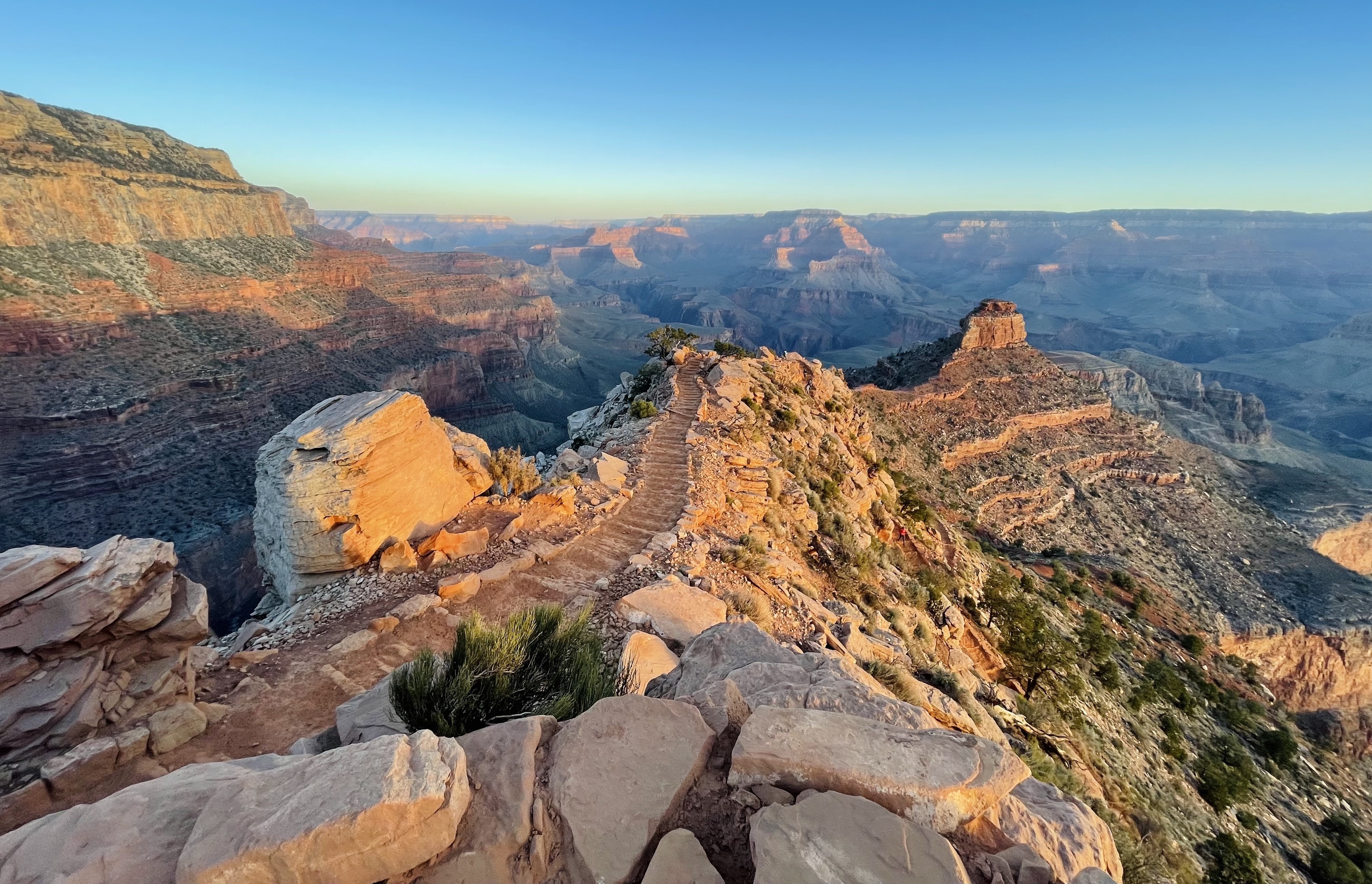
Figure 1.2: View from near the Ooh Aah Point (6660 ft elevation)
Descending down the South Kaibab trail was enjoyable because it is a fairly gradual slope, so it is not as hard on the knees. Different sections of the descent brought unique views and perspective.
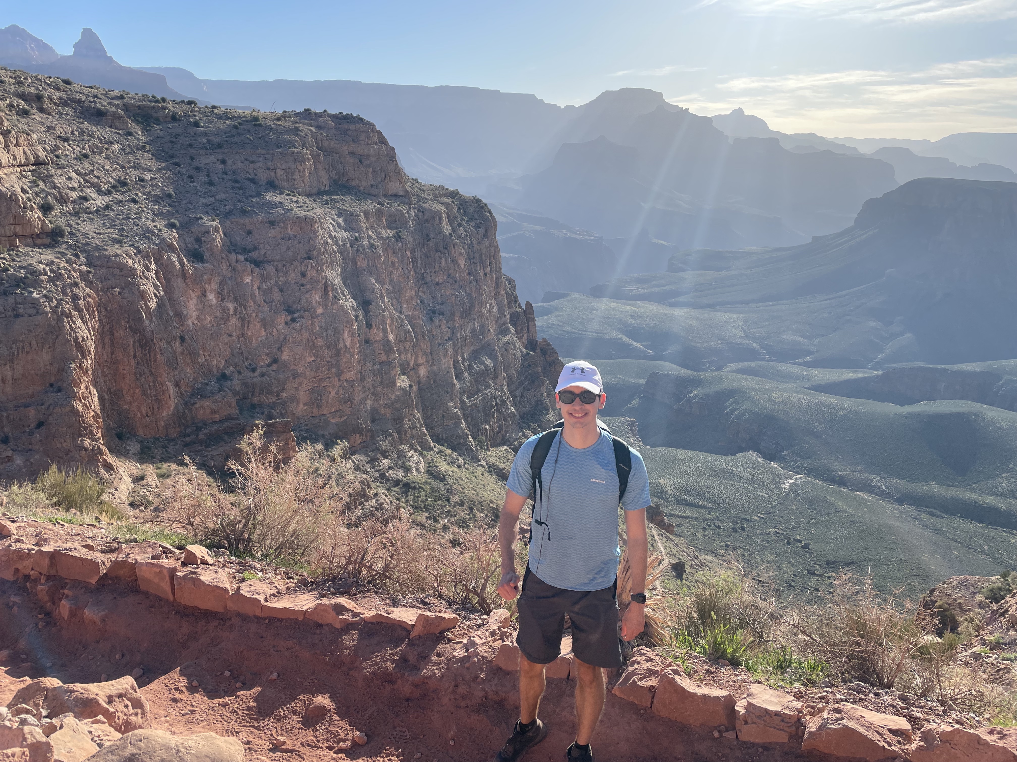
Figure 1.3: View around 2 hours into the descent on the South Kaibab trail, near Cedar Ridge
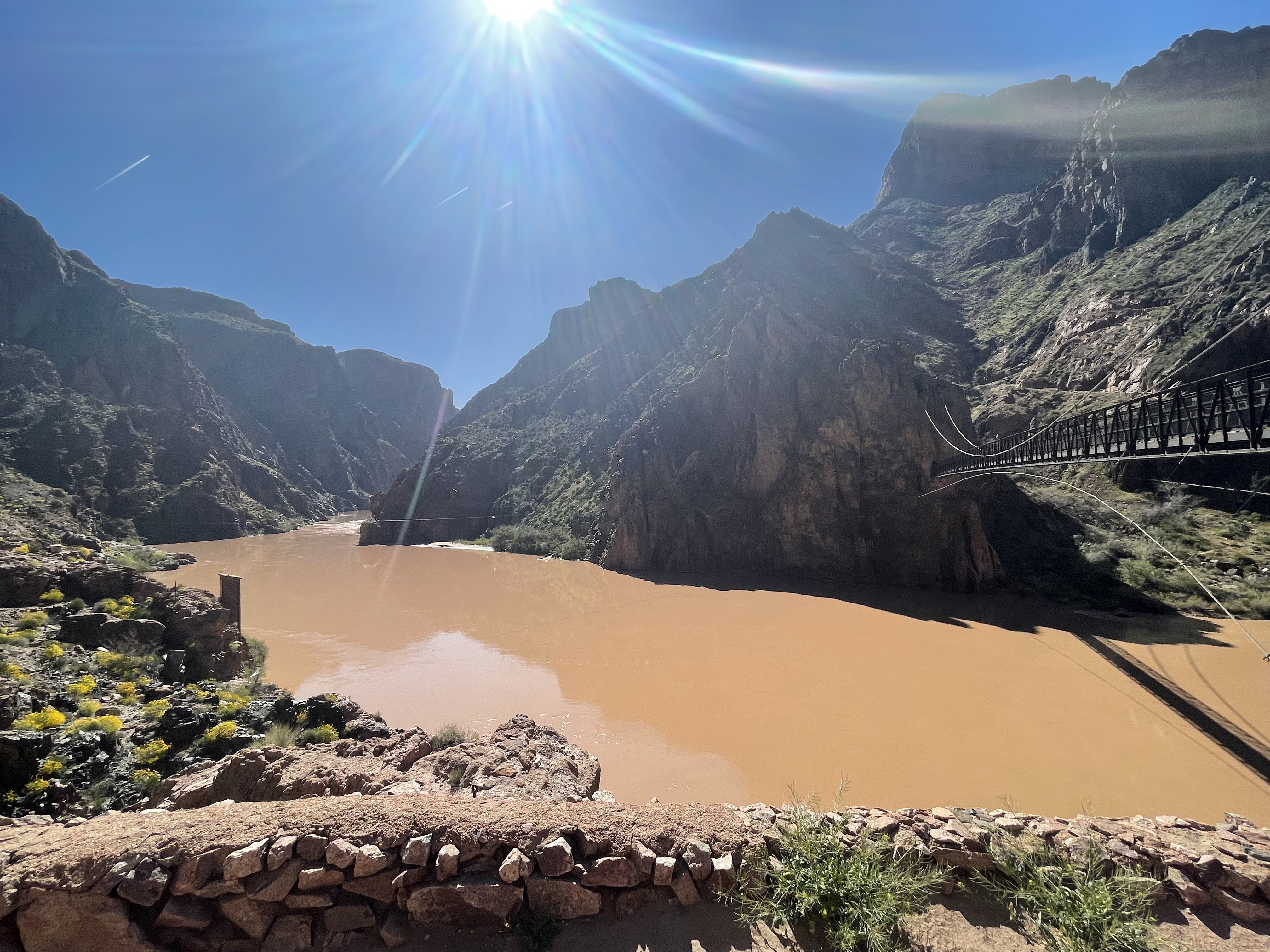
Figure 1.4: The Colorado River at the bottom of the Grand Canyon. The water wasn’t the cleanest!
Unlike a mountain summit where if the difficulty climbing presents to be too difficult you could elect to turn around early and descend, here that isn’t an option. Furthermore, it is hot at the bottom of the canyon.
I didn’t have any issues going back up, but my friends found it to be a streneous effort. I went ahead and left two of my friends to go up together behind me. Unfortunately, one of them bonked (ran out of glycogen), resulting in dizziness, nauseau, and fatigue.
This quickly became a pressing issue because as I was waiting at the top, it was getting dark and my friends were nowhere to be found! One of them eventually made their way up, but my friend who bonked was still in the Canyon. Luckily, he eventually got cellular signal closer to the top of the Canyon and we were able to get into contact with him. He made it right as it was getting dark.
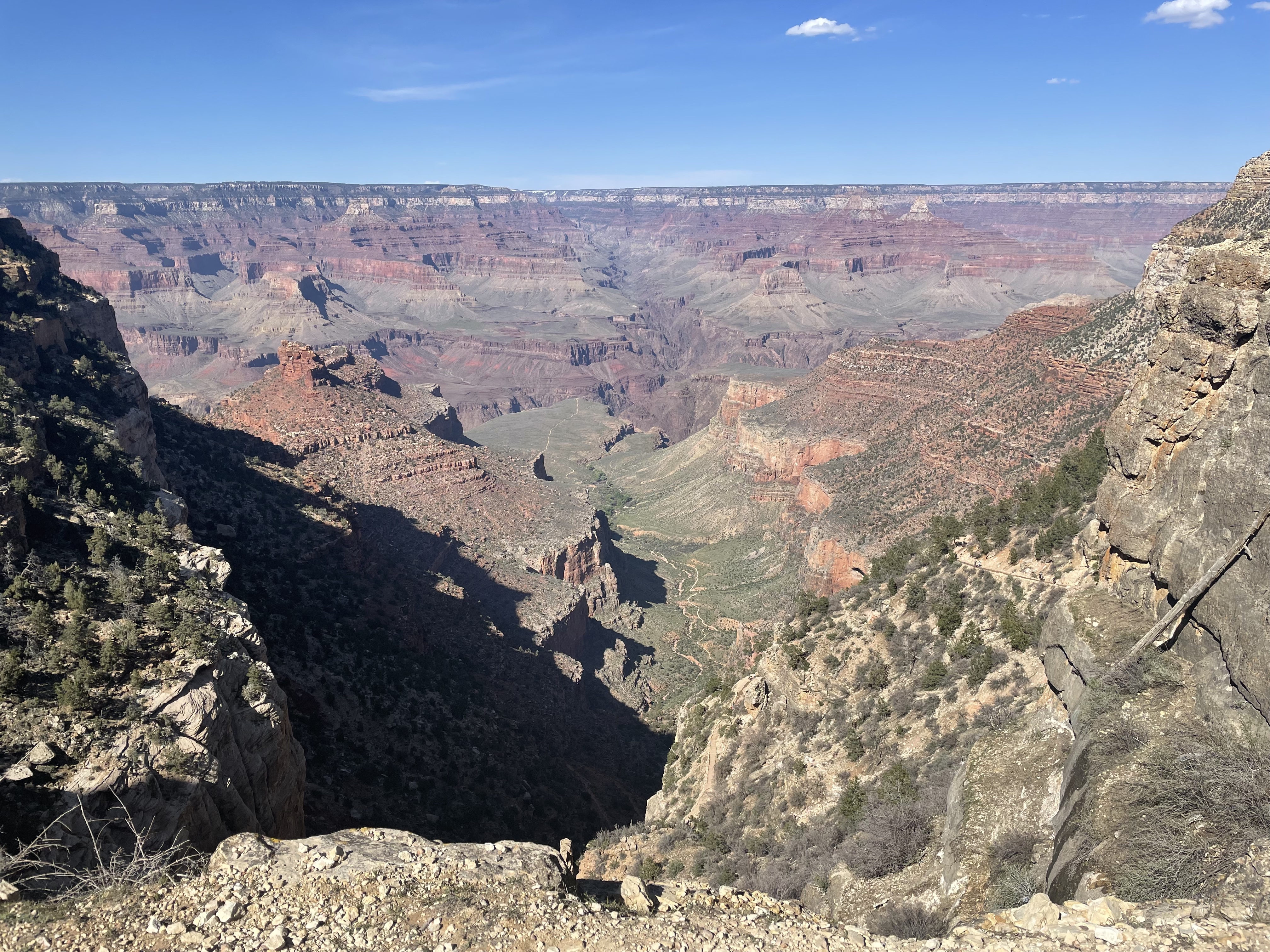
Figure 1.5: Near the summit after climbing up Bright Angel. To my surprise, there were still snow and ice patches near the top (which would make sense considering it’s at nearly 6750ft elevation)
Overall, the Grand Canyon was a great experience and doing the “Rim to River to Rim” hike showcases a wide array of scenic views and sceneries that make it worthwhile effort!
Las Vegas
As an intermediate to the next leg of the trip, we drove to Las Vegas as our new “headquarters”. Personally, I did not find Las Vegas very enjoyable, but some of the shows were moderately interesting. The main turnoff for me was that smoking was common everywhere, and to get into our hotel we passed through a casino that was smoke-filled…
Figure 2.1: The Welcome to Fabulous Las Vegas sign. It was a bit out of the way, though naturally it was on the edge of the city.
Figure 2.2: Quick stop by Hoover Dam which was along the way to Las Vegas
Death Valley
We then ventured over to California to checkout Death Valley. This day trip showed some interesting view-points. It wasn’t that warm in California as advertised.
Figure 3.1: Zabriskie Point
Figure 3.2: Badwater Basin - the lowest point in North America (282ft below sea level) comprised mainly of sodium chloride (table salt)
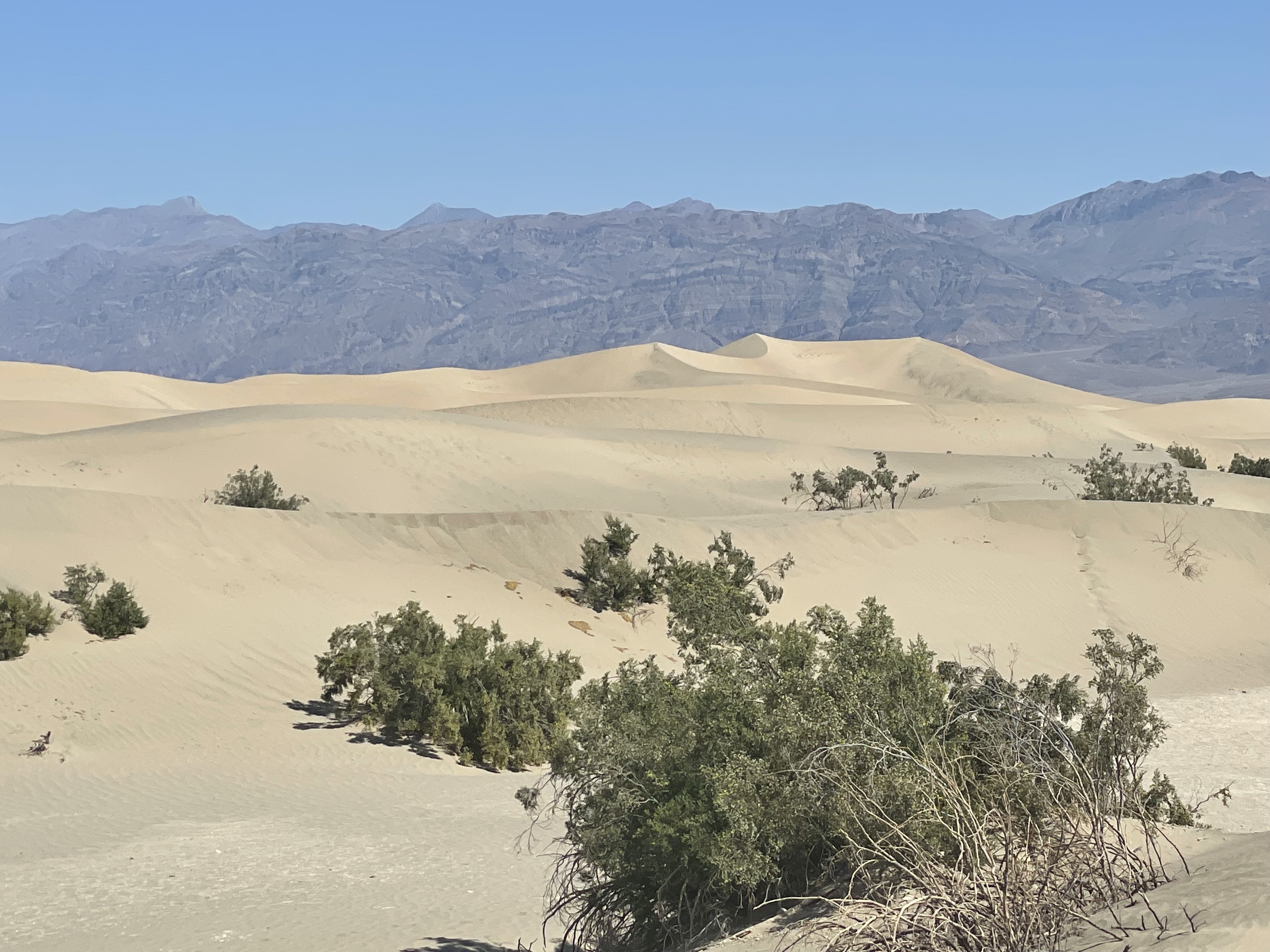
Figure 3.3: Sand Dunes
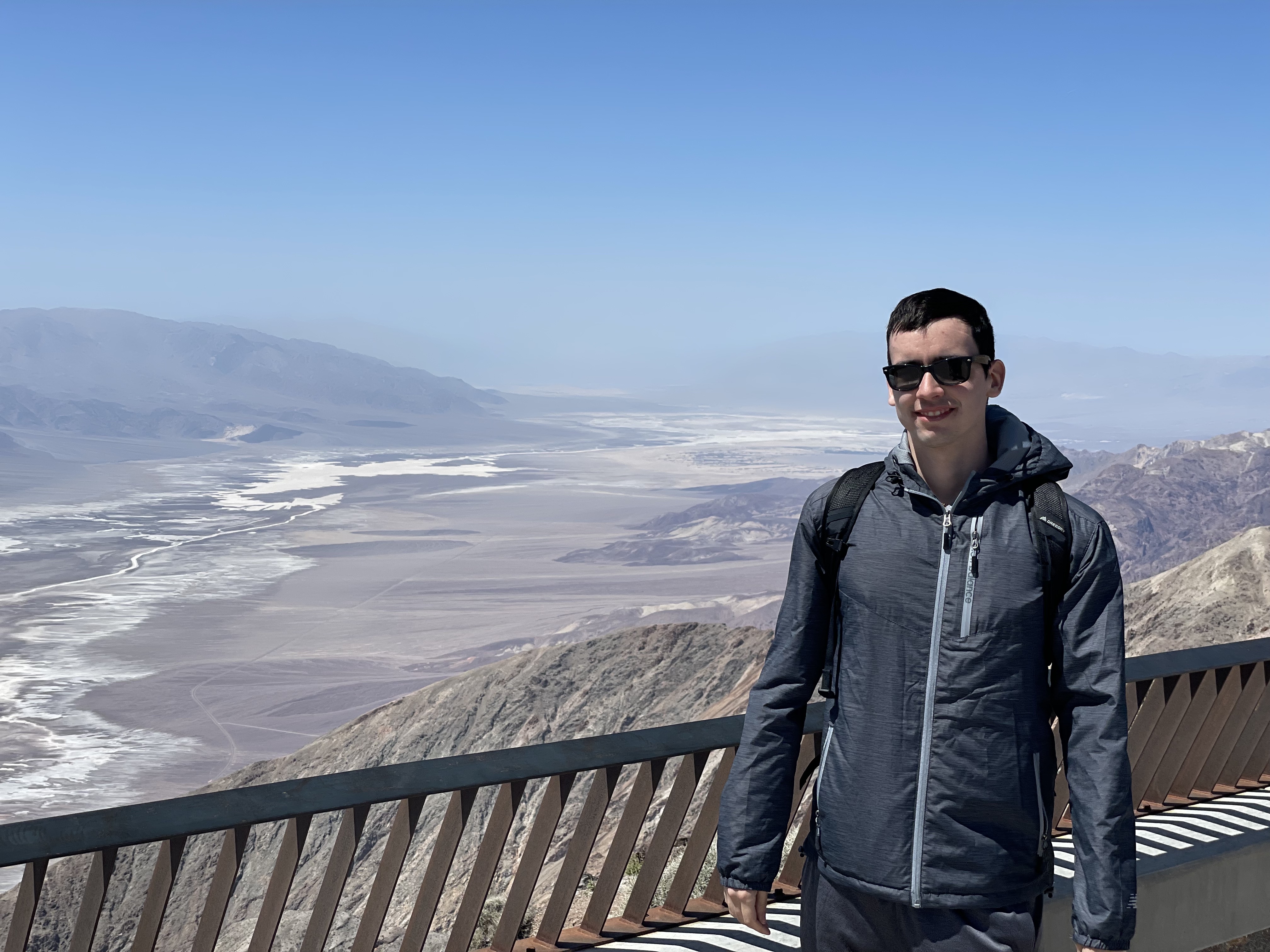
Figure 3.4: Dante’s Point overlooking the Badwater Basin (5575ft)
Zion
Zion has a series of flagship hikes including “Angel’s Landing” and “The Narrows”. Unfortunately, we didn’t have a reservation for Angel’s Landing and the water was not in good condition for “The Narrows”. This wasn’t an issue, as there was still plenty to visit in our two days at the park!
First, we did the Observation Point via East Mesa Trail hike. This is arguably the best viewpoint at the park, though due a rockslide you cannot hike from the base of Zion but go through the East Mesa trail instead.
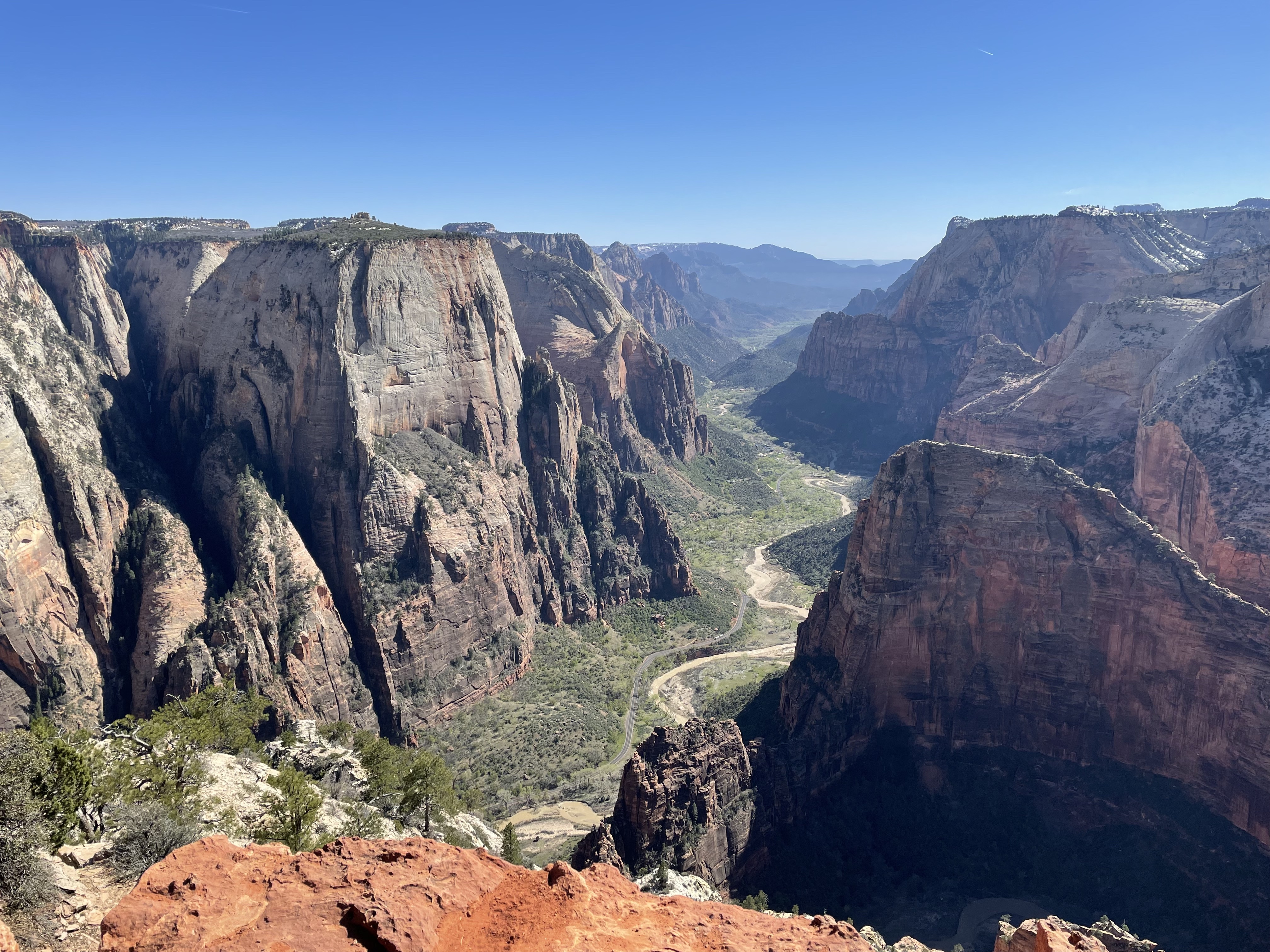
Figure 4.1: View from observation point. You can see Angel’s Landing
The actual hike was not very enjoyable. There was a lot of snow melt, which made it impassible by car to the trail-head so we endured an extra 4.3 mile on the hike because we had to park at the Zion Ponderosa ranch, while making the actual traversal tricky. It was relatively flat with no view-points until the very end.
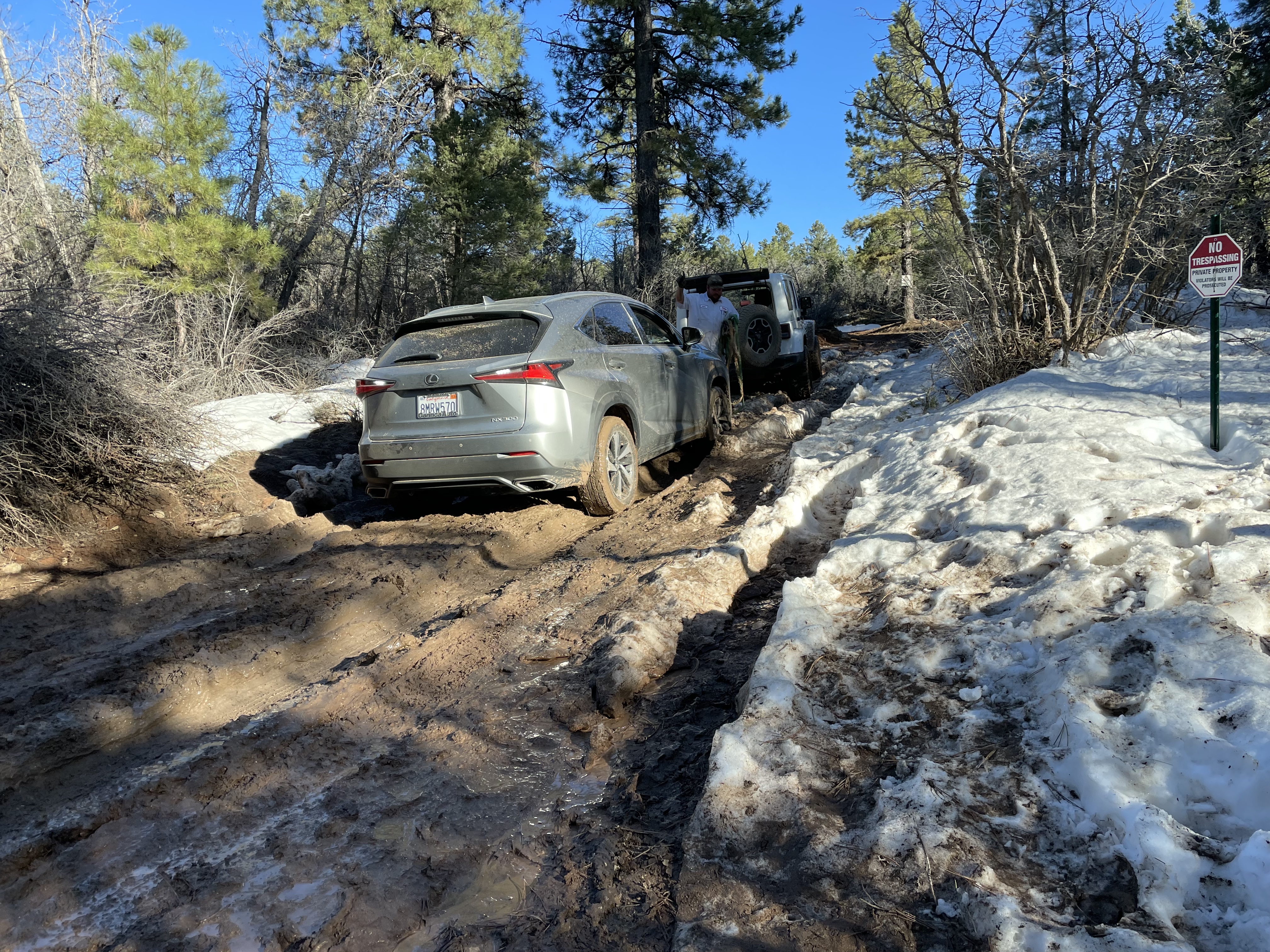
Figure 4.2: One of many cars that failed to make it to the trail-head. There was a truck waiting on the private road that charges $1000 to tow any stuck cars (the day we went was quite profitable)
The rest was a constellation of smaller hikes we chained together, including Pa’arus, Emerald Pools (low/mid/upper), and Riverside Walk.
Figure 4.3: Sunrise overlooking the Virgin River after running ~5K from Springdale (and the Pa’arus trail). There were many wild animals before sunrise, running in the dark was kind of sketchy
Figure 4.4: Lower Emerald Pools
Figure 4.5: Upper Emerald Pools. The hike was light but the views paled in comparison to Observation Point, and it was very crowded. Some parts of the hike had a queue…
Conclusion
The trip was an exciting turn of hikes across many picturesque canyons and vistas. However, this only scratched the surface, with plenty of trails and parks left to visit in the area such as Bryce Canyon and Antelope Canyon … so a lot to look forward to!